


Install as app
Faster access like an app
Install Pinlog as a Progressive Web App (PWA) directly via your browser – no app store needed.
Install Pinlog as app
As a PWA directly via your browser
- Uncomplicated documentation: Record the location and photos of your finds immediately with GPS and just a few clicks.
- Flexible data exports: Export your data securely in KML, GPX, CSV or PDF for versatile use and archiving.
- Extensive geodata: Access modern and historical maps, high-resolution aerial images and detailed Lidar data worldwide and specifically for Germany, Austria, Switzerland and the Czech Republic.
- Professional photo editing: Optimize your found photos directly in the app with integrated Photopea tools.
- Detailed statistics: Analyze your find activities with comprehensive statistics and discover patterns and trends to optimize your search.
Whether you are an amateur or a professional searcher, Pinlog provides you with all the tools you need to efficiently document your discoveries and continuously improve your search strategies. Concentrate fully on your search for new finds, while Pinlog takes care of the rest.
Get started with Pinlog today and take your search to the next level!
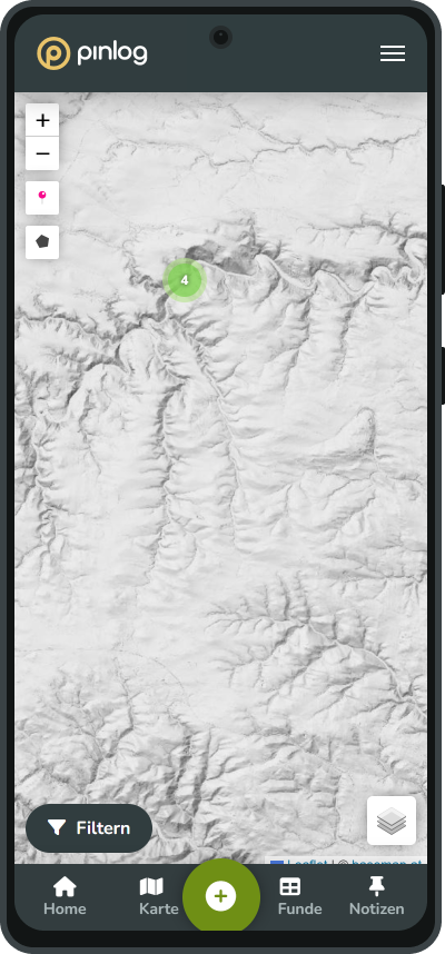

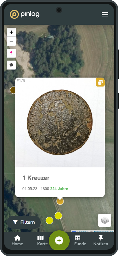
Easily document your finds via the app
- Immediate location and photo recording: Use GPS to mark the exact location and record your find with a photo. A few clicks and both the coordinates and the visual documentation are saved.
- Time saving: The quick logging of location, photos and other details directly on site gives you more time for the essentials - your search. Everything important is recorded in seconds, so you can get on with the next find straight away.
Pinlog provides detailed documentation for every metal detector find, quickly and easily. So you can concentrate fully on your next metal detector search.
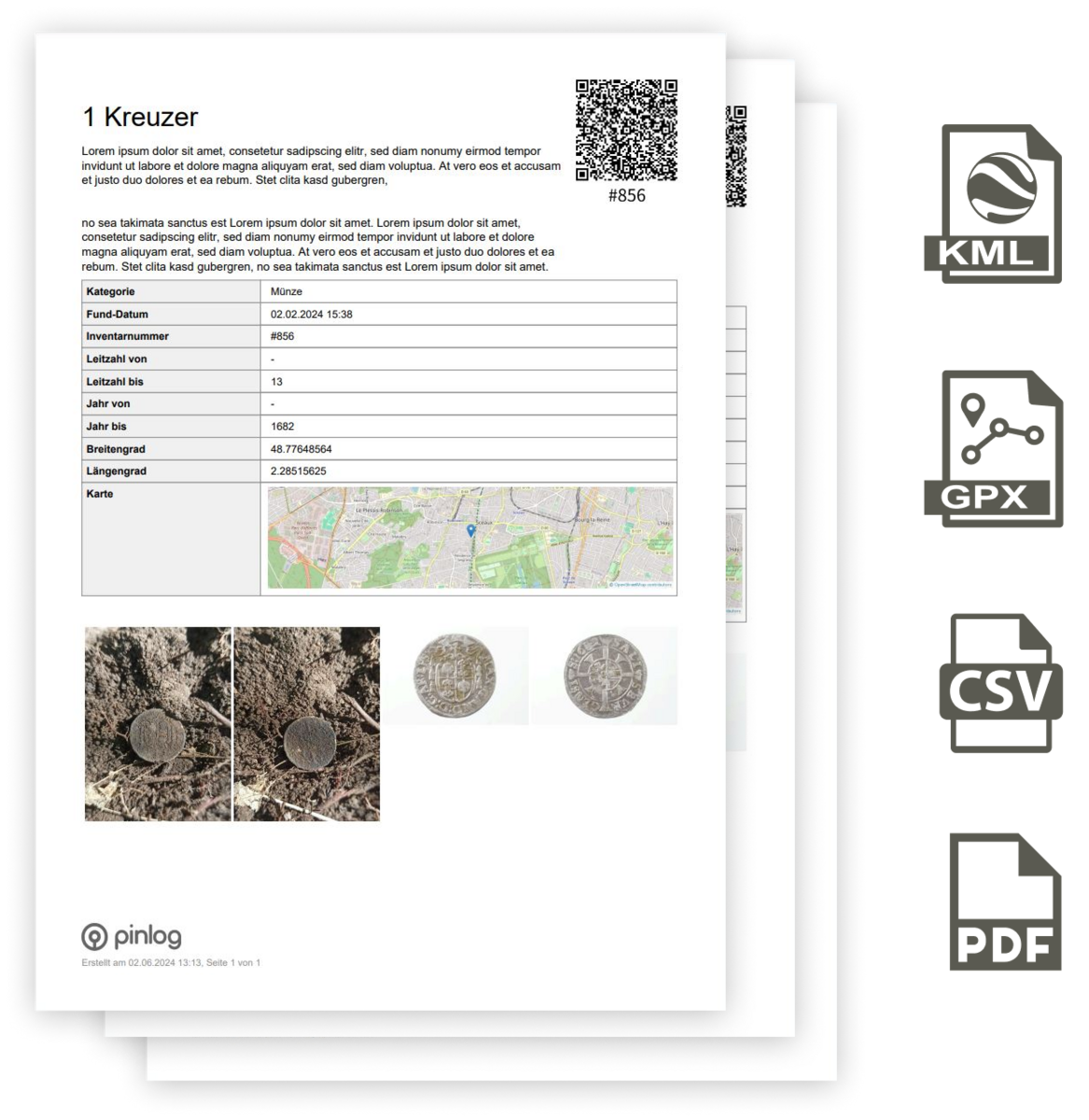
Export your find data flexibly and securely
KML export for mapping software: Visualize your finds in Google Earth or Google Maps. With one click, your find data is exported and can be seamlessly imported into these tools.
GPX export for navigation devices: Export your finds for GPS devices and navigation apps. This enables precise navigation to your locations and efficient planning of your search areas.
CSV export for spreadsheets: Process your data in Excel for detailed analysis and reports. Ideal for printing and physically archiving your find documentation.
PDF export for reports and archiving: Download your find data as a PDF. This feature allows you to create detailed reports that you can print and store safely.
With Pinlog, you have all the options you need to comprehensively save your find documentation and reuse it flexibly. So you can concentrate fully on the essentials - the search for new finds.

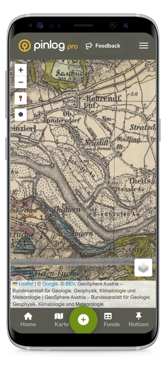
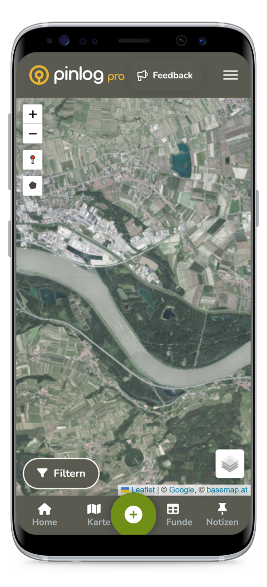
Access to historical maps and lidar data
Map material:
- OpenStreetMap: Global mapping details for comprehensive orientation.
- Basemap (AT): Basic maps for Austria with a focus on topographical and urban details.
- Basemap Gray (AT): Simple and clear map view for Austria.
- Historical - Geosphere 1 and 2 (AT): Historical maps showing changes in the Austrian landscape over time.
Aerial images:
- Google Satellite: Satellite images for worldwide location viewing.
- Orthophoto (AT): Detailed aerial images of Austria for precise local inspections.
Lidar data:
- Lidar (Global), Lidar (AT) and Lidar (CZ): Data for analyzing the topography worldwide and specifically for Austria and the Czech Republic.
- Lidar- Enhanced (AT) and Lidar - Enhanced (CZ): Contrast enhanced and Lidar data to better recognize minimal features
- Lidar - Surface (AT): Extended data sets for a detailed view of the ground surface in Austria.
These comprehensive datasets provide you with a precise basis for planning and analyzing your search activities by making modern and historical geodata accessible directly in the app.
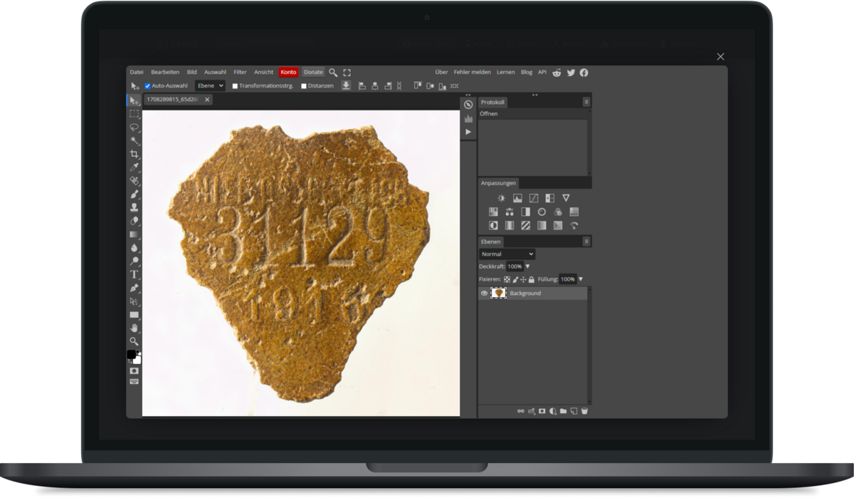
Advanced photo editing with Photopea
Use the power of Photopea directly in Pinlog for professional photo editing:
- Powerful photo editing: Edit your photos with a wide range of professional tools – directly in your browser, with no extra software required.
- Detail improvements: Adjust white balance, optimize brightness and contrast to make your finds appear in the best light.
- Perfect presentation: Make sure every detail and structure of your finds are clearly visible
These editing options are seamlessly integrated into Pinlog, so you can edit your finds directly and efficiently.
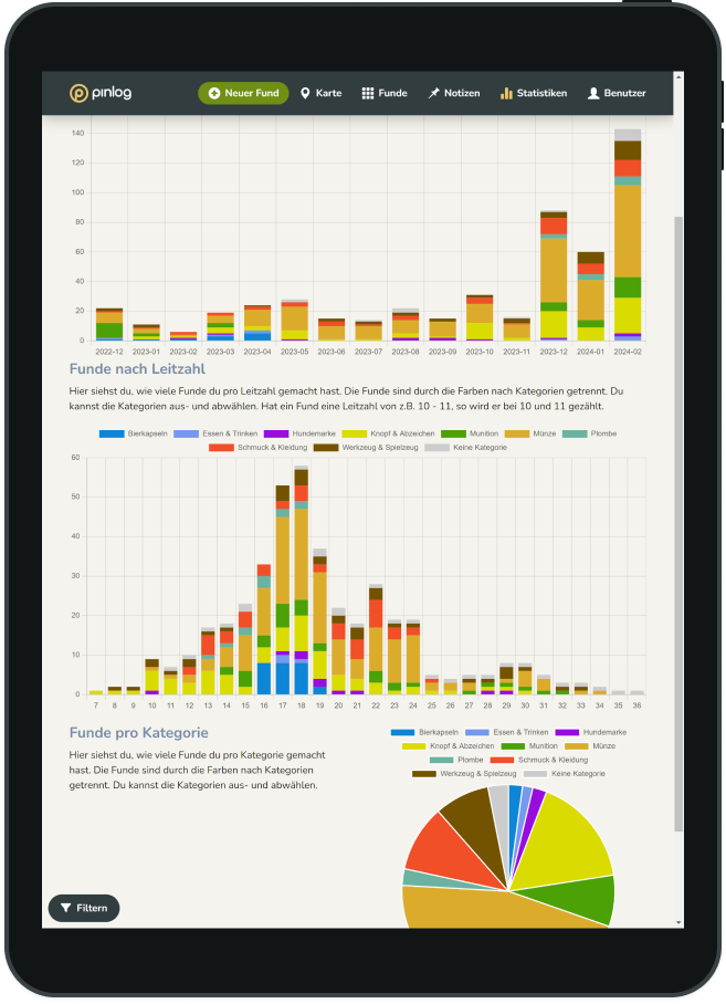
Statistics on your finds
Use the comprehensive statistics in Pinlog Pro to gain detailed insights into your finding activities.
Finds per month
- Overview: See how many finds you have made in each month.
- Interactivity: Select or deselect individual categories to filter the view according to your interests.
Finds by guide number
- Detailed view: Visualize the number of finds by their guide number.
- Double counting: Finds with a guide number that spans two values (e.g. 10 - 11) are counted for both values.
- Customizability: The display is also in different colors for each category, and you can selectively show or hide categories.
Finds per category
- Category-specific analysis: Record how many finds you have made in each category.
- Visual separation: Each category is represented by its own color.
- Personalization: Activate or deactivate categories to customize the statistics according to your preferences.
These statistics tools allow you to identify patterns and trends in your search activity and optimize your search accordingly.

Marking fields and interesting places
In Pinlog Pro you can mark specific fields and plots of land for which you have permission to search, or interesting places that you have discovered on historical maps, for example.
- Permission markers: Make sure you always know which plots you are allowed to enter by marking them on the map. This will help you organize your search activities and avoid legal problems.
- Historical discoveries: Use the historical maps in Pinlog Pro to identify potentially worthwhile search areas. Mark these locations on your map to easily find them again during your walks.
- Access and management: All markers are saved in your account and can be edited or removed if necessary. You have quick access to your marked locations at any time, making it easier to plan and carry out your searches.
Use these functions to plan your explorations efficiently and systematically and to ensure that you have an overview of all interesting and permitted areas.